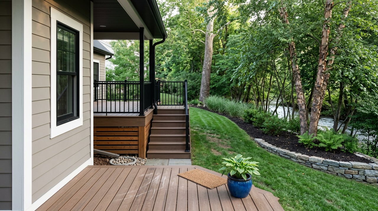
Picture yourself sipping coffee while the Watauga shimmers below or the Roan Highlands glow at sunrise. If you are dreaming of a view home in Elizabethton, you have great options, from in-town river corridors to ridge and lake settings. The key is knowing what “river” and “mountain” views really mean here, plus the due diligence that protects your investment. This guide breaks down locations, lifestyle perks, and the five must-check items before you make an offer. Let’s dive in.
River and mountain views defined
River views in Elizabethton
“River view” can mean a few different things in Carter County. Some homes sit on or near the Doe or Watauga River banks, offering direct water access. Others are set above the valley with long looks over the water and less flood exposure. Upstream, Watauga Lake and the tailwaters below the dams offer scenic water outlooks and boating access. The Tennessee Valley Authority manages lake levels and dam releases, which can change water conditions quickly for recreation and shoreline areas. You can review current operations on the TVA Watauga Dam and reservoir page.
Mountain views and scenery
“Mountain view” homes are often on ridgelines, benchland above the valleys, or on engineered pads along slopes. Many buyers here seek sightlines toward Roan Mountain and the Roan Highlands, along with nearby Cherokee National Forest peaks. Expect tradeoffs: bigger views usually come with steeper driveways, more vegetation care, and potential well and septic needs. The region’s outdoor draw, including Roan Mountain and the Appalachian Trail, makes these outlooks a year-round lifestyle feature.
Where to look
In-town river corridors
Elizabethton’s river character is strongest along the Doe and Watauga through town. You will find homes with water outlooks and quick access to everyday needs, healthcare, and the Tweetsie Trail. The Tweetsie Trail connects Elizabethton and Johnson City for biking and walking, and in-town locations typically shorten commutes across the Tri-Cities.
Watauga Lake and tailwaters
If you want lake scenery, small-acreage cabins and second homes dot the Watauga Lake area a short drive upstream. Anglers and boaters prize these waters for trout, bass, and quiet coves. Review access points and fishing basics through the TWRA’s Watauga Reservoir resource. Because TVA controls lake levels and downstream releases, factor in seasonal changes and boating safety near dams and tailwaters. You can monitor current operations on the TVA Watauga page.
Ridges and benchland outside town
For wider mountain views, look at ridgetop and benchland homes and parcels beyond the city center. These spots often trade easy access for bigger vistas and privacy. Verify the road situation, winter maintenance, and utility availability. Many ridge properties need on-site septic and sometimes a private well, which affects both timelines and costs.
Lifestyle and recreation
You are never far from outdoor time here. The Doe and Watauga Rivers are known for trout and paddling, while Watauga Lake offers boating and calm coves. Roan Mountain and the Appalachian Trail sit within an easy drive for hiking and leaf season. In town, the Tweetsie Trail and Sycamore Shoals area provide everyday recreation without a long car ride. This mix of access and scenery is a big reason view properties hold appeal in the Elizabethton market.
The five must-check items before you write an offer
- Exact FEMA flood zone and elevation. Riverfront and low-lying areas can sit in a Special Flood Hazard Area. Run the property address through the FEMA Flood Map Service Center and ask for an elevation certificate if one exists. Local context matters. In fall 2024, remnants of Hurricane Helene produced a historic crest on the Watauga and Doe Rivers, as reported by the Elizabethton Star. Review that event for awareness using the Elizabethton Star coverage. For ongoing and historical water levels, check the USGS Doe River gauge page.
- Septic permit or municipal sewer. If the home is not on city sewer, you will need a valid septic system and reserve area that meets state standards. In Tennessee, permits for new or repaired systems are issued by TDEC’s Division of Water Resources. Review the process on the TDEC septic construction permit page and plan for soil mapping or percolation testing as needed.
- Private well records and water test. Rural view homes may rely on a private well. Tennessee regulates well construction through licensed drillers, but ongoing water quality testing is a homeowner responsibility. Request any available well log and recent results, and plan to test. The state outlines best practices on the Tennessee Department of Health private water supply page.
- Recorded easements and covenants. There is no automatic legal right to a view. Protecting a view often requires recorded easements or HOA covenants. Have your title professional review the deed, plats, and any CC&Rs. Ask about neighboring lots and development rights that could affect your outlook in the future.
- Access, driveway, and utilities. Many ridge and riverside properties use private roads or steep driveways. Confirm legal access and maintenance obligations, along with utility availability. For local permitting questions, sight-distance standards, and driveway approvals, consult the city’s planning and permit portal.
Costs, insurance, and lending
Flood insurance is usually required by lenders if a property lies in a FEMA Special Flood Hazard Area. Pricing depends on elevation, construction, and coverage levels. Learn the basics through FloodSmart, the NFIP resource, and obtain a quote early in your search. If you are considering a river-access lifestyle, remember that TVA operations on Watauga can change conditions quickly, which affects dock use and safety.
Mountain-view and slope sites can involve higher build or improvement costs for grading, drainage, and retaining structures. Rural utilities sometimes require additional extensions, and vegetation management is ongoing. Unusual features or limited comparable sales can also influence appraisal and underwriting. A local lender with experience in view and rural properties can help you navigate these issues early.
Smart offer strategy
- Prioritize contingencies that protect you: flood zone verification, insurance quotes, well water testing, and septic evaluations.
- Ask for the seller’s property disclosure, especially for any past flood or water intrusion events, septic repairs, or access issues.
- Review title for easements and covenants that affect access, utilities, and views. If preserving a view is critical, discuss recorded solutions with your closing attorney.
- Confirm utility providers, typical outage response, and any HOA or private road agreements.
- If you want river access or a dock, verify the feasibility with current water levels, TVA advisories, and any shoreline rules.
Quick due-diligence checklist
- Run the full address in the FEMA Map Service Center and save the map report.
- Review historical and current levels on the USGS Doe River gauge and note past flood headlines via the Elizabethton Star.
- If not on sewer, review the TDEC septic permit guide; arrange soil mapping or perc testing.
- If on a private well, follow testing guidance from the Tennessee Department of Health.
- Get a flood insurance quote from your insurer and study NFIP basics at FloodSmart.
- Confirm access, driveway standards, and permits using the city’s planning and permit portal.
- For boating and water recreation plans, monitor TVA Watauga operations and review local fishing and lake info from TWRA’s Watauga Reservoir page.
If you want a friendly, local partner to help you balance scenery, access, and long-term value, reach out to Matt Fleenor for buyer representation and local guidance across Elizabethton and the Tri-Cities.
FAQs
What counts as “river view” versus “riverfront” in Elizabethton?
- “Riverfront” typically means the property touches the riverbank, while “river view” can be elevated or set back with a look over the water; verify the exact location and flood zone on the FEMA Map Service Center.
How do I check flood risk for a Doe or Watauga River home?
- Search the address on the FEMA Flood Map Service Center, ask for an elevation certificate, and review local history such as the 2024 flood event reported by the Elizabethton Star.
Do TVA dam releases affect living near the river?
- Yes; flows can change quickly below the dams and tailwaters, which impacts boating, fishing, and shoreline conditions; monitor the TVA Watauga operations page for current information.
What should I know about wells and septic on ridge or lake homes?
- Many view properties rely on private wells and on-site septic; review the TDEC septic permit process and testing guidance from the Tennessee Department of Health.
How can I estimate insurance costs for a river-area home?
- If the property is in a Special Flood Hazard Area, lenders typically require flood insurance; learn coverage basics and ask your insurer for a quote using resources at FloodSmart.